The Making of "The Nepean" - Day 6
First Shown: 7 December 2018 on YouTube
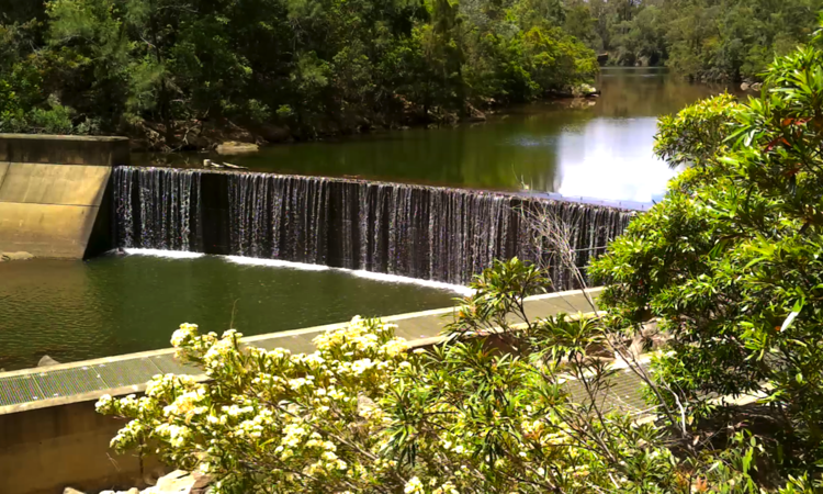
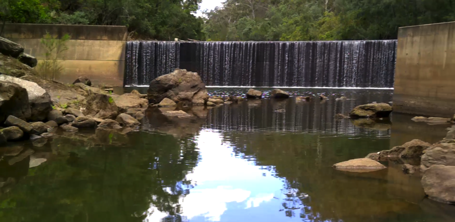
We visited another weir today called Theresa Park Weir and a bridge at Wallacia called Blaxland's Crossing. I earlier called the weir Gulguer Weir, before I knew better, because it is situated in the Gulguer Nature Reserve. I think the name I gave it is far better because of that.
We had thoroughly researched the weir site for Day 5 and knew this one was going to be difficult. According to a local, Mr Tedesco, the only way to reach the weir was from McKee Road and through a property he owned called 'Serengeritty'. I explained that the tennents wife, Dimity, would not allow us entry as Jamie was at work elsewhere and she wanted his opinion. I left my number for Jamie to ring me and we left. He didn't ring.
I deliberately picked today for the return to 'Serengeritty', as according to Dimity, Jamie was home on Sundays. We arrived at the front gate and began recording our daily intro. On completion, Jamie and Dimity drove up after being in town and a conversation ensued. The outcome being that Jamie and Dimity would escort us to the weir because in the past 'fishermen and others' had made a terrible mess that inlude dumping a wrecked car. We promised not to dump my car. I like my car.
We stopped at their farmhouse while they swapped their road vehicle for a 4wd farm buggy similar to the one Jeff drove on Day 1 at Fullcircle Farm and off we went, Jamie and Dimity in their buggy followed by me in my Toyota Forerunner, around to the rear of the house, a sharp turn around the rotary clothes hoist, through two gates and along a well made dirt road towards the weir. It was bumpy and a bit overgrown but manageable, until... we came to a fallen tree across the road.
As Jamie began to winch the tree to the side of the road I mentioned to Jeff, "I guess we would not have made it to the weir on our own. I don't carry a winch." With the tree successfully removed from the track our two vehicle convoy arrived at the weir and what a peaceful, untouched beauty it is.
Dimity remarked, "You see now why we don't want people down here." I agreed. With that said, Jamie and Dimity decided to go home. They must have trusted that we would not mess things up. We didn't mess things up. In all our travels so far, we have left nothing behind.
As we did in Day 5 we stopped for a late lunch at the Wallacia Hotel them went over to Blaxland Crossing Reserve no more than 200m from the hotel to get video from the bridge and surrounds. We've driven across this bridge many times during our day trips but never stopped, until now.
Blaxland Crossing is named after the site John Blaxland used to cross the Nepean River to reach his property on the western bank where his cattle grazed on the fertile river flats. In 1813, Governor Macquarie granted this land to John, the brother of explorer Gregory, which encompassed much of present day Luddenham and Wallacia. John named his property ‘Luddenham’ and built a homestead where Wallacia is today.
The first bridge built here was a wooden low level bridge and consequently every small flood in the river suspended all traffic, for three or four days, until the water receeded. A new high-level bridge was built in 1896 much to the relief of local residents, especially those who lived in Werombi.
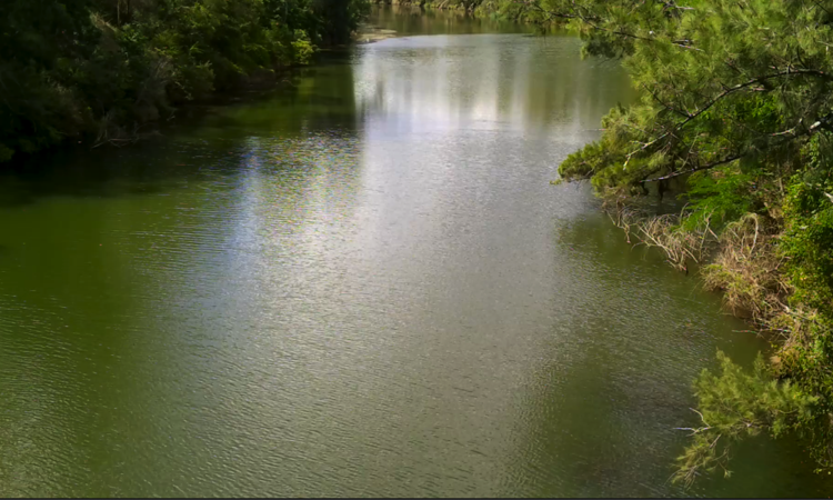
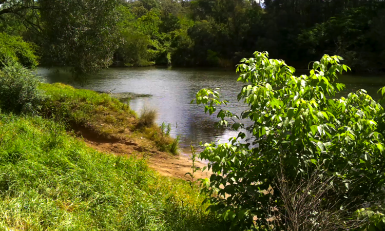
Here today, as you will see, the Nepean is a quiet peaceful river, that no longer breaks its banks since the water regulators release very little water into it from the dams upstream. We saw children and young adults playing and picnicing along the river bank and a fisherman trying to catch a meal. There was a sandy beach in the Reserve for those who cannot travel to the ocean shore and plenty of tree shade to sit under on a hot summer day.