The Making of "The Nepean" - Day 10
First Shown: 15 February 2019 on YouTube
Today is going to be HISTORIC. Today we go in search of the source of the Nepean River. To our knowledge no-one has ever been-to and seen the source. You can't Google 'the Source'. With research and maps in hand we head off south 130kms by road to a little place called East Kangaloon.
Using precise distance calculations we arrive at a gate almost hidden from the road 900m east of the intersection of Kangaloon and Kirkland roads. Be warned there is a sign here that reads, "No Entry Penalty $11,000". Jeff was worried. I checked the coin tray in the vehicle... "No worries, I've got it covered," I suggested.
We record our daily intro at the car then head off for a long walk. The weather is great so we expect to get a little overheated. Here are the walking directions:
Walk 275m turn right, then 617m to Transmission Lines
Walk 225m east along track to middle of clearing (20 mins)
Turn right into bush and walk SE 925m to Source (total 50 mins)
Arrive at coordinates: -34.566341, 150.602897 (Google Maps)
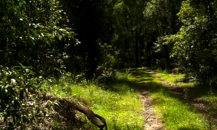
Following a well defined track we made good progress through the right turn, to the transmission lines and to the middle of the clearing. We made one mistake, veering right along a minor track but it led to the southern end of the clearing so we gained a little time. The forest here is beautiful. So green, lush and (except for the trail) untouched by man, with trees straight and tall. I'll let The Sydney Mail and New South Wales Advertiser of 1876 describe the scenery of this region called the 'Yarrawa Brush':
"The Yarrawa Brush with its immense morasses, its dense and varied timber, its ragged gullies and overhanging cliffs, and its sparkling waterfalls, are well worthy the visits of artist or sportsman, or indeed of any one desirous of breathing the fresh air of heaven or enjoying Nature in her beautiful and ever-changing moods."
Every official report of the early 1800's of the eastern area, known as the Yarrawa Brush, contained references to bush that was too thick to penetrate, forests of huge trees, and roads that were too steep and narrow for normal traffic. But we were walking easy on this trail. At least to the end of the clearing since it was in a valley.
Then it happened, during the final 925m walk into the bush to the Source, our trek turned into a nightmare. We entered an undergrowth of chest high ferns with grasses, fallen branches and large logs underneath. It made our progress almost impossible. We pushed on, step by step, feeling the lay of the ground with hesitant feet. Above the carpet of ferns we looked like human heads moving across a green field between the trees.
Our timetable was shot to pieces. Backtracking and side turns took valuable time from us. We had three more locations to vist today. But we kept on.
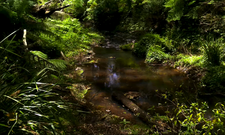
Eventually we reached our objective, the start of the Nepean, a place where two east/west riverlets meet head on and turn north for a 176km meander to the Hawkesbury River.
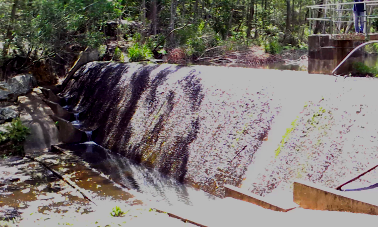
Fortunately for us our second location for the day was not far from the car so we walked back from the source to the intersection where we made our first turn right and continued 400m until we reached the Robertson Burrawang Weir.
This weir was built by the Wingecarribee Shire Council as a water supply reservoir at East Kangaloon. It was built in 1971 but no longer serves as a water supply. A water treatment plant, sludge lagoons and a pump station were formerly located on the southern side of the reservoir, but have now been removed. Once finished videoing here we set off back to the car.
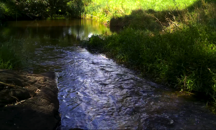
Our third and final stops were on Moresby Hill and Tourist roads where the Nepean passed underneath. While not memorable places we stopped there to show how much water was flowing 5.5km and 8.1km respectively, from the source.
That was a long day but so worth the trip. The video we recorded is amazing. You'll love it.