The Making of "The Nepean" - Day 1
First Shown: 15 October 2018 on YouTube
Welcome to The Making of 'The Nepean' a series of weekly trips I will be making to produce a documentary on the Nepean River in New South Wales. The Nepean River rises in the Southern Highlands about 140kms by road from Sydney and ends at the junction of the Gross River in Agnes Banks, near Richmond, where their combined waters become the Hawkesbury River that flows into the sea. The Nepean is 176.6kms long and flows in a northerly direction through a dam, numerous weirs and under many bridges.
Although, my documentary will start at the source of the river and end when it ends, we will not record in that order. Each recording day will be composed of places, sometimes grouped together and other times only one or two locations, according the distance and/or difficulty of obtaining the video I need.
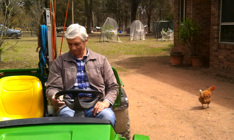
Today was Day 1 and I had planned a busy day. We drove to Wilton a small country region 77kms south of Sydney to visit Fullcircle Farm where we attempted to video the junction of the Nepean and Bargo rivers. I say attempted because we really didn't see it close enough to show the joining of the waters. We really only saw the Bargo River valley from a distance and the Nepean River below. We were given a 'Gator', a farm buggy, to carry us to the boundary of the farm but after that the undergrowth was too thick and the walk too long to fit into our tight schedule. Besides, I organised lunch at the farm and we couldn't be too late for that.
Special thanks to Sharryn at Fullcircle for an extravagant meal and interesting discussion on the Nepean River. She called it the 'Nepean Pools' and explained that no water could be obtained from the Nepean, and how little water the farm got via rainfall and town water. On a future trip we will investigate Pheasants Nest Weir situated just upstream from the farm and maybe we will see why the Nepean is so dry between the weir and the Bargo junction. With lunch over we said goodbye and headed a few kilometres north to view the Maldon Weir.
The Maldon Weir was constructed in 1968 to provide a permanent fresh water supply for Blue Circle Southern Cement Ltd. This weir was critical for the operation of the cement works at the time, however pumping for the cement works now takes place approximately 300 metres downstream of the weir crest and not from the weir pool. Despite having been identified as a major barrier to fish migration the Maldon Weir has not be equipped with a fishway. Although made aware of the fish migration issue, the weir owner Blue Circle, has done nothing to assist.
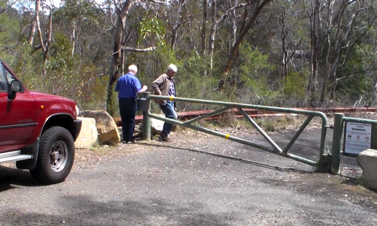
The weir is now closed to all traffic and blocked off at either end. There is no parking and the gate into the abandoned road is locked so we had to park up the road and walk down. Roughly 300m down the abandoned road over the armco barrier we saw the Maldon Weir. It is said, the weir offered a nice swimming spot and people often slid down the weir on crates. I didn't see any of that.
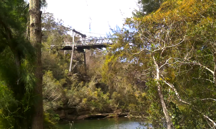
Next location was the Maldon Suspension Bridge. It is 210m further down the road and like the weir it is no longer used now that a modern road bridge on Picton Road has been built upstream. Our last stop today was that bridge.
Built in 1903, the suspension bridge replaced, Harvey's Crossing a stone causeway at water level that had steep difficult approaches down the sides of the gorge and was constantly being damaged by floods, causing traffic delays and requiring expensive maintenance. In 1939, the timber towers were severely damaged by a bushfire that swept through the gorge and the structure was deemed recoverable. A temporary ford was provided while constructing a new bridge that included steel towers. However, the steep winding approaches and the low load capacity of the suspension bridge warranted a replacement.
Without delay we drove as close as possible to the uncompleted Maldon to Dombarton Rail Bridge, which turned out to be not very close, as we had to leave the car at a locked gate with another 2.8kms to walk. Along the way we met a cow with a new born calf, an echidna, a wallaby and Jeff saw a black snake. None of which came too close so that was okay. The proposed Maldon to Dombarton Railway is a 35km single-track rail freight line between the Main South Line at Maldon and Dombarton (near Port Kembla), in the Illawarra region of NSW.
Construction on the line started in 1983 but was suspended in 1988 due to an economic downturn and the forecast growth in coal traffic not eventuating. By that time, around 25kms of earthworks (such as major cuttings and embankments) had been completed and ballast had been installed. A bridge and tunnel portals were also partially built.
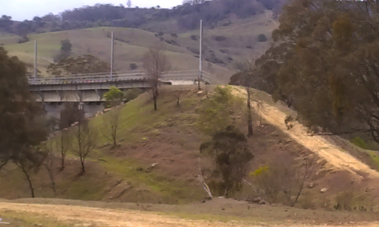
Our last location for the day was a stop at the bridge over the Nepean on Picton Road. The traffic was busy here so we deployed our safety signs and put on our fluro-vests. Safety first. It was interesting to see the area and compare the quantity of water flowing in the Nepean above and below Blue Circle's pumping station. I do not know how much water they are taking but it appears considerable.
Well, that wraps it up for Day 1. We had a great day and are looking forward to Day 2. I hope you enjoy watching it as much as we did recording it for you. Good-bye for now.