The Blue Mountains Lookouts & Waterfalls
Episode 10
First Shown: 25 January, 2021 on YouTube
Wentworth Falls Lookouts & Falls - Lower Areas
This episode finishes the scenic locations in the area of Wentworth Falls that we visited. As mentioned in my last blog, while this episode roughly follows the same direction taken in the last one, we walk the paths below the escarpment, not in the valley floor, but higher up.
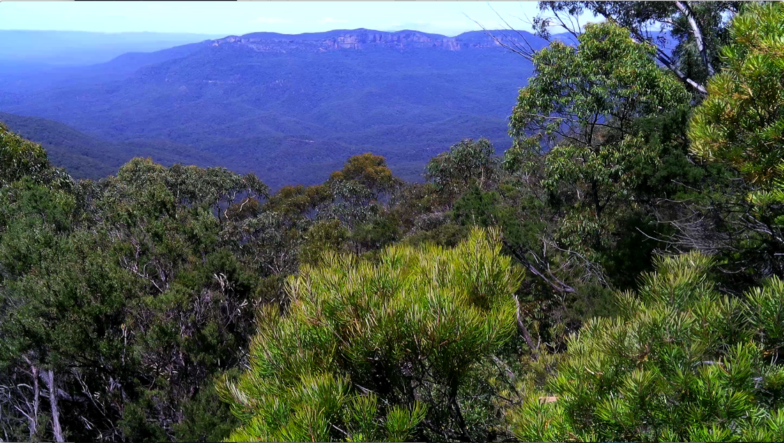
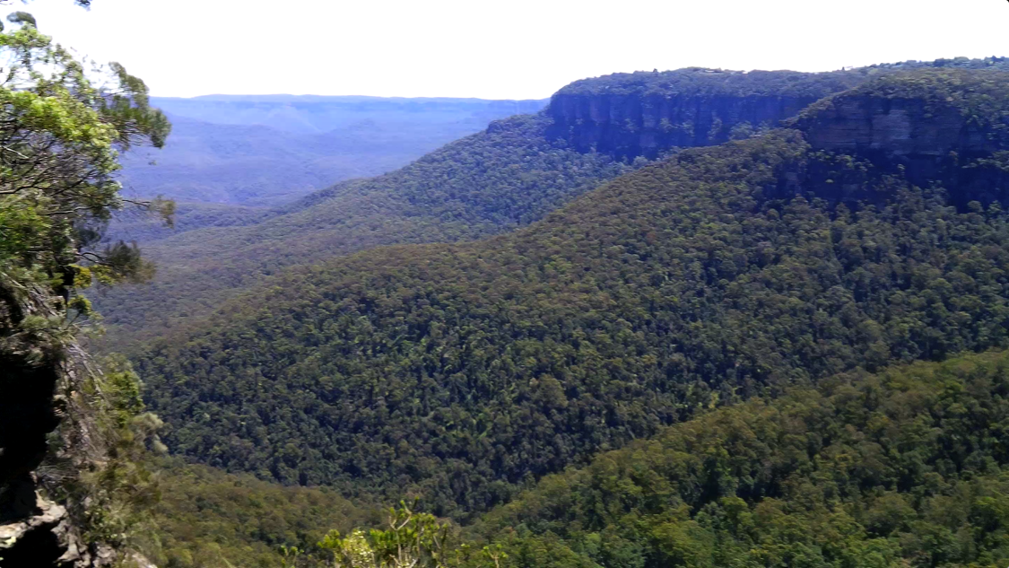
Jamison Lookout is the first lookout that is reached from the Wentworth Falls Picnic Area carpark. It was named by Governor Lachlan Macquarie, after his friend Sir John Jamison (1776-1844). This lookout gives extensive views over the Jamison Valley and the Kings Tableland. Sir Burrell Drive was constructed and opened to traffic as a Scenic Drive in 1934 and gave access to this lookout.
Originally, Governor Macquarie referred to the valley of Jamison creek above Wentworth Falls that includes Darwins walk along Jamison Creek as Jamison's Valley. In his diary, the Governor wrote, "a very extensive pretty valley, with a sum of very fine fresh water, with tolerable good Feed for Cattle, and is exactly halfway between Emu Ford and Cox River. I have this day named this place Jamison’s Valley." Many newspapers of the time called it Jamieson's Valley.
As I have mentioned in previous episodes many geographical locations in the Blue Mountains were first named by the NSW Governor Lachlan Macquarie who made an historic journey from Sydney to the Western Plains beyond the mountains, in May of 1815. During his outbound journey he named The King's Tableland and peered down from it (possibly from Lincoln's Rock - Episode 9) and at the bottom he saw a glen, "as romantically beautiful as can be imagined, bounded on the further side by Mountains of great magnitude, terminating equally abruptly as the others; and the whole thickly covered with timber, a picturesque and remarkable tract of country". He gave it the name, "The Prince Regent's Glen." Under what circumstances, the little valley with the creek and Sir Charles Darwin’s walk, lost it's Jamison's Vally status, I do not know, but The Prince Regent's Glen faded into obscurity when it was given the Jamison Valley title.
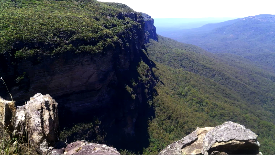
Princes Rock Lookout is a lookout below and between Jamison Lookout and Wentworth Falls Lookout. Until the end of the 1880’s this lookout was unnamed. In late 1889, the Australian Town and Country Journal described the lookout as a "natural platform of water-worn rock" and The Sydney Morning Herald published an article that called the lookout "a rock platform". It wasn’t until the following year that it was given the name Princes Rock, possibly, because the valley was then known as Prince Regent’s Glen and named after Prince Alfred Ernest Albert, Duke of Edinburgh (1844-1900), who visited this area on the 31st January, 1868.
The Nepean Times of March 1891, printed, "Princes Rock is the finest look-out over the falls, and as the way is steep, garden seats are placed at intervals so that the tourist may rest and contemplate the lovely scene. Here solitude reigns supreme, the only sounds heard being the noise of rushing water in the distance and the sighing of the breeze through the treetops."
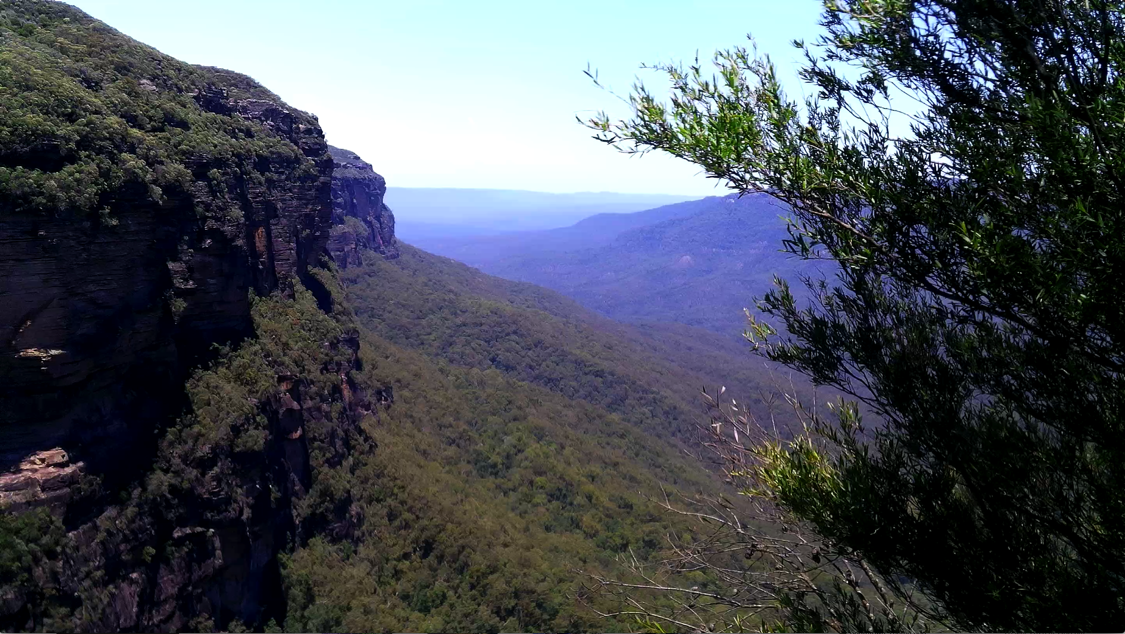
Eagle's Nest Lookout In 1894 a place nearby was called Eagle’s Nest. A newspaper at the time published this, "Perhaps the finest view is that obtained from an outlook in the vicinity of the Eagle's Nest, a hole in the western wall of rock, from which the most timid may gaze, without a sense of fear, at the great cascade." Eagle’s Nest has long been forgotten and it is possibly because in the lead-up to, and during World War II, "Eagle Nest" became well known as Hitler’s Hideout.
I did, however, find and record in this episode, an unnamed lookout beneath Princes Rock, on the Undercliff Track, that is "perhaps the finest view" of Wentworth Falls. You decide... is this Eagle's Nest Lookout?
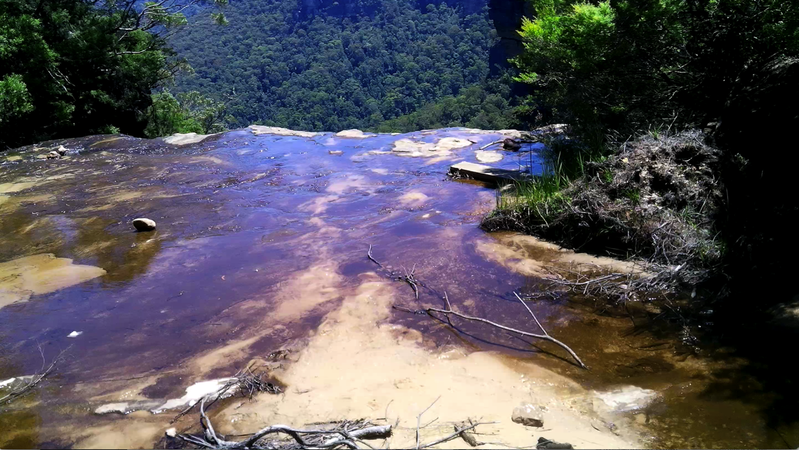
Wentworth Falls Following the Undercliff Track east we crossed the Fletcher’s Lookout side path, turned right and walked past the Queen’s Cascade (Episode 9) to the top of Wentworth Falls.
When Governor Macquarie travelled to Bathurst in 1815, he named this waterfall Campbell Cataract (after Secretary Campbell). In mid 1825 the Marquis de Bougainville, who commanded the French discovery ship La Thetis that was lying in Sydney Harbour, was shown the Campbell Cataract and by some unknown authority promptly renamed it the Bougainville Cataract.
Well, that didn’t go down well with the locals and with the Weatherboard Inn giving its name to the area, the falls were known as the Weatherboard Falls. The Marquis did not get his way for long and after 1879, when the new railway station first took the name, Wentworth Falls the Campbell Cataract became Wentworth Falls.
Connected with this wonderful place there is a legend about the inhumanity of the keeper of a 'shanty' near the precipice. It goes something like this, "In the early days of the colony. Before railways were thought of, gold diggers had to use the road, and this 'shanty,' where grog was sold on the sly, was often resorted to by those who wanted shelter and rest. As the story goes, the keeper used to lure lucky gold diggers to the precipice, rob them, and then pitch them over into the valley beneath". I can imagine, this was a tale, told late at night, around the early bush campfires.
Arched Cave is near and below Rocket Point lookout, Wentworth Falls. It is a descriptive name for this geomorphological feature. It was first called Oxley's Grotto and named so by Governor Macquarie upon his return trip from Bathurst to Sydney on 17th May 1815. He named this cave after the Surveyor General John Oxley. Later, it was called Rock Archway, until now, Arched Cave.
In 1890 the path to the Arched Cave ended at the cave where a good view of the Wentworth Falls was obtained. A description in the St George Call newspaper, of 1905 reads, "It is when, crossing the secured pinioned timber plank which serves as a footbridge across the Jamison Creek and mounting the hillside on which Rocket Point and the Arched Cave are situated, that a full view of the Gorge is seen. It is here that the valley is deepest, and the rocks most abrupt in the whole mountain range. One stands almost upon the rim of a huge natural basin with precipitous rocks, scarred by the rains of ages and reddened with ironstone stains, on either side."
In 1908, the National Pass Walking Track was completed. It connects Arched Cave with the Conservation Hut and can be walked from either end. The track passes through the Jamison Valley, with a large section of the track built into the side of the cliff, allowing for beautiful views of the Valley and beyond. From the Arched Cave it's a steep walk down The Grand Stairway, a set of hand-carved stone steps that connects the top of the waterfall with the valley below. The western end of the National Pass Walking Track enters the Valley of the Waters, a beautiful part of the Blue Mountains with countless small waterfalls and a steep path with more hand-carved stone steps. (See Episode 11)