The Blue Mountains Lookouts & Waterfalls
Episode 9
First Shown: 4 December, 2020 on YouTube
Wentworth Falls Lookouts & Falls - Upper Areas
There are at least nine great scenic locations in the area of Wentworth Falls. That is too many for one episode so I have divided them into two. While both episodes roughly follow in the same direction, in this one, we walk the paths on top of the escarpment and in the next, Episode 10, we walk the lower tracks that are not in the valley floor but higher up.
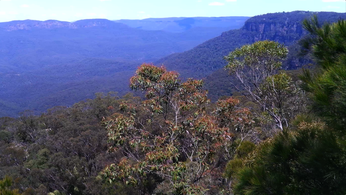
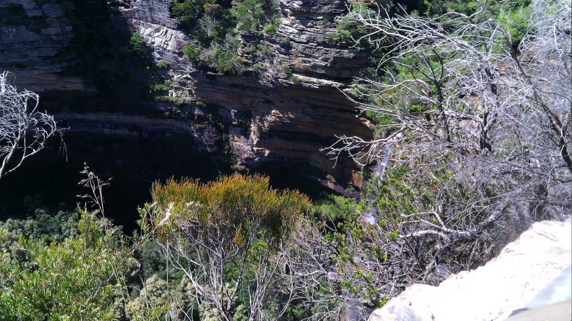
Wentworth Falls Lookout is the second of two lookouts that are in the Wentworth Falls Picnic Area on Sir Henry Burrell Drive. Jamison Lookout is located at the western end of the picnic area, near the car park, and will be visited in Episode 10. Wentworth Falls Lookout is located at the eastern end of the picnic area, close to the waterfall, and has a panoramic view of the Jamison Valley and Wentworth Falls. From here, the multitude of people who cannot walk the tracks and climb the multitude of steps, can look across and down upon the 305m (1000ft) fall of water of the Wentworth Falls.
This lookout is now named after the Wentworth Falls waterfall, but it wasn't always known by that name. When this area was first explored around 1813, this lookout was just another rocky ledge that offered a view of the top of the falls and the valley below and was not named. I've been unable to find out when and by whom this lookout was named Wentworth Falls Lookout.
As I mentioned in the last episode many geographical locations in the Blue Mountains were first named by the NSW Governor Lachlan Macquarie who made an historic journey from Sydney to the Western Plains beyond the mountains, in May of 1815. During his outbound journey he named The King's Tableland and peered down from it (possibly from Lincoln's Rock - Episode 9) and at the bottom he saw a glen, "as romantically beautiful as can be imagined, bounded on the further side by Mountains of great magnitude, terminating equally abruptly as the others; and the whole thickly covered with timber, a picturesque and remarkable tract of country". He gave it the name, "The Prince Regent's Glen." From where he stood he could not see the (Wentworth Falls) waterfall and it wasn't until during his return journey that it was discovered.
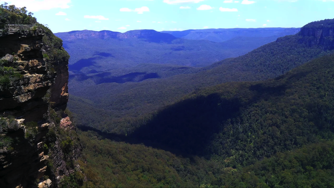
Fletcher's Lookout is located east of Wentworth Falls Lookout along the Wentworth Falls Walking Track that ultimately leads to the bottom of the falls. Another way to walk to Fletcher’s Lookout and all the locations mentioned here, is via Sir Charles Darwin Walk that starts in Wilson Park on the Great Western Highway and follows the Jamison Creek. If you are walking from Wentworth Falls station it will probably be the path you prefer at a distance of 2.8km from the highway, past numerous small unnamed cascades and the Weeping Rock to get to Fletcher’s Lookout.
The lookout was named after David Fletcher, born in 1825 and died in 1890. He purchased 5 parcels of land along the top of the cliff line on 23 October 1876 and in 1878 he became one of the earliest trustees for this reserve, known then as the Weatherboard. In 1889 the lookout was sometimes called Fletcher’s Outlook.
The March 1889, Nepean Times carried an article that is quite descriptive:
"By alternate slopes and steps we come to a semi-circular stone-built nook, provided with a seat, which is called Fletcher's Outlook, whence yet another and splendid view of the falls is gained, and we can clearly trace the complete course of the water till it reaches the pool. Hence we ascend to a higher level where the ledge grows wider and the valley is seen to better advantage as more of the overhanging clouds disperse and uncover the distant vale. We are now beyond the sound of the falls with their tuneful splash, and the whole scene is enwrapt in unbroken silence, whilst no human tenement is visible to dispute the sway of nature in all her pristine glory clad."
Fletcher’s Lookout is now in three sections and has views almost directly over the top of Wentworth Falls and into the valley below.
Weeping Rock "One cannot but picture. its appearance with the sun shining brightly upon it illuming and making it sparkle and glisten as a shower of myriads of tiny diamond. This spray falls some 40 feet (12m) into a self-made basin below, where it gaily dances as it falls and then disappears along the valley beneath the dense foliage. The immediate course of the falls has long since worn bare, but either side of it is begemmed with bright greenery." Journalist's had a way with words in 1889.
The Weeping Rock is a rock formation within Jamison Creek, above Queen's Cascade and about 100m above Wentworth Falls. It was named for its continuous flow of water that trickles over this partly isolated mass of rock, giving the appearance of weeping tears. This feature was very common on postcards from the early 1900’s.
To reach Weeping Rock from Fletcher’s Lookout walk back 20m to the cross tracks where a turn right takes you further along the Wentworth Falls Walking track. Another 40m and turn left onto the Weeping Rock Walking Track and 50m more to reach the rock. Access can also be made from the highway by way of Sir Charles Darwins Walk.
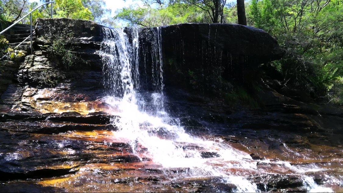
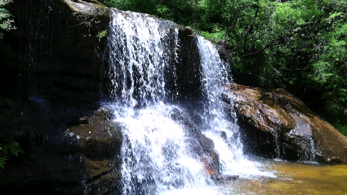
Queen's Cascade is a series of small waterfalls on Jamison Creek, approximately 20m above Wentworth falls. From the Weeping Rock the track continues downhill and offers glimpses of the upper parts of Queen's Cascade through the undergrowth until the bottom is reached.
When Governor Macquarie visited this place, in 1815, he named the cascade and falls by one name Campbell Cascade. This is what was published in, The Sydney Gazette on the 8th of July, 1815, "The Governor, on his return over the King's Table Land, had much gratification in beholding a Cataract of immense height, which falls over a precipice little short of 1000 feet down to the Prince Regent's Glen, forming one of the most stupendous and grand sights that perhaps the world can afford. This Cataract having been discovered by four Gentlemen of the Governor's party, His Excellency has been pleased to give it the name of one of them, by calling it "The Campbell Cataract," after John Thomas Campbell, the secretary."
By 1898, the cataract and falls had been separated and the cascade was named after Queen Victoria (1819-1901). Other names were Queen’s Cataract and the Golden Sands, Wentworth Cascades and The Cascades.
Rocket Point Lookout is situated high above the Arch Cave Rocket Point Walking Track that is commonly called "The Grand Staircase”. From Queen’s Cascades follow the track past the top of Wentworth Falls and at 30m turn left at the stone sign with a sculptured lizard on it, and labelled National Pass. Turn immediately up the hill at a small sign on your right and turn either left or right on a circular track that ends at the lookout (left track is 230m - right track is a little shorter).
Officially, the origin of the name is unknown. It was possibly named by Peter Joseph Mulheran (1851-1936), the caretaker and ranger for the Wentworth Falls Trust, 1879-1919. Mulheran helped to initiate and construct walking tracks throughout this area. The explanation of the actual name may be that rockets were let off at this high point of land for some particular reason.
I believe I have found an explanation for the name Rocket Point. It all started in May of 1902 when a news item from Britain was reported in the Sydney Sunday Times on the Coronation of King Edward the seventh. It read, "Coronation night in London is to be made brilliant by a chain of bonfires extending throughout the length and breadth of the three kingdoms." Our Sydney reporter then wrote, "Is anything like this to be attempted Australia?"
We all know how Australians respond to challenges and Bonfire Night became an annual event. In May of 1913 this item appeared in the Nepean Times, "In connection with the chain of bonfires between the Canoblas and Prospect Hill, 55 of which have been promised, there may be other districts that would like to form a link in the chain on Wednesday next, May 28 (Centenary night). The programme is, Light up at 7 p.m. and signal to neighbouring bonfires by rockets or fire balloons."
Were rockets fired into the sky on Centenary Night in 1913 from a [ STONE LEDGE ] high above the Arch Cave? Was it this event that inspired the name Rocket Point. I say so.