The Blue Mountains Lookouts & Waterfalls
Episode 4
First Shown: 21 August, 2020 on YouTube
Burgess Falls, Oaklands Falls & Horseshoe Falls
I had to break this episode into two parts as there were too many interesting features to capture on video. So Part 1 is the walk to Burgess Falls and the falls themselves. Part 2 follows shortly with the remaining two waterfalls.
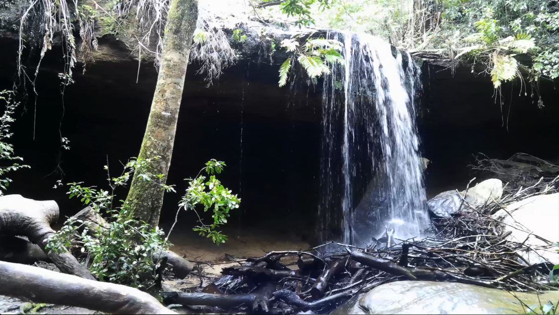
Burgess Falls The water flow is not great, even after rain, however it is still very pretty and is a must see. It is suggested to do this walk after heavy rain for the optimum experience. Walking access is by a 80m side track that is very steep at the start then levels to pass under two separate huge overhanging rocks, before dropping to the sandy bottom at the base of the falls. Fungi and moss covered rocks give a sombre feel to the scene. If you're a fun guy, (sorry) Autumn is a good time to visit as there is a huge array of Fungi to see.
These Falls are located on Burgess Falls Creek and named after Edward Allen Burgess (1879-1917), who was killed in WWI on the western front on 3 June 1917, at the age of 38. Burgess Falls was named and opened on 7 October 1918. Mr J. Counsell donated the necessary painted sign boards and there was erected an honour board, which had been inscribed by Mr. Counsell. The trustees made a new track from Horseshoe Falls to the foot of Burgess Falls.
In 1920, army buddies of the dead soldier obtained permission from the trustees to improve the place, and for several weeks, they journeyed from Sydney and else-where to put in hard, solid work, with the pleasing result that the spot was transformed and beautified. The digger in charge was Sergt. Donnolly, D. C. M. who was ably assisted by Lieut. K. Slater M.C., Lieut. Vic. Levitt, War Off, N. Burgess, M.M. and bar and Croix de Guerre, Sergt. H. Harrison, M.S.M., Sergt. J. Hoskins, Sergt. J. Meirkill, Corp. C. Chow, and Sapper H. Burgess. A marble tablet, bearing a suitable inscription, was let into the rock, and a bridge 15m long, christened the "Diggers' Bridge," lead to the bottom of the falls, where ample seating accommodation had been provided. The past 100 years, however, have seen everything but the marble tablet removed by fire and water.
Burgess Falls is not on Google Maps so I have given Google latitude and longitude reading I have taken, (33°42'42.7"S 150°27'52.0"E) for insertion onto the map.
Oaklands Falls are within Hazelbrook Creek, 280m NW of Burgess Falls. The track was constructed by the trustees from Horseshoe Falls to Oaklands Falls in 1920 while in the process of clearing a path to Burgess Falls. This fall was named after Oaklands Farm and subdivision, so called because portion of the estate faced Oaklands Road. The estate was for many years the property of Mr. H. S. S. Bond and his brother. But they disposed of it in 1914, and the purchaser immediately subdivided the land before offering it to the public.
Oaklands Falls is not on Google Maps and I have determined, after being there and taking latitude and Longitude readings (33°42'37.8"S 150°27'46.0"E), that these falls are where Horseshoe Falls is listed. So, I have again contacted Google and requested a correction.
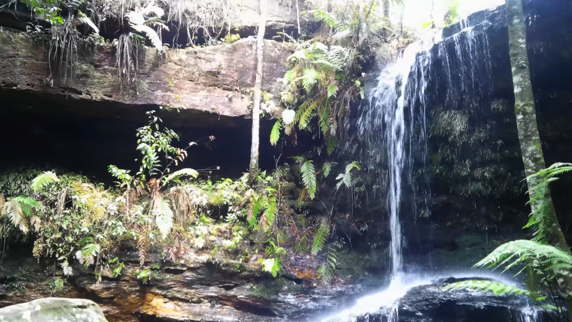
Horseshoe Falls are on Hazelbrook Creek upstream from Oaklands Falls and within Horseshoe Reserve. Access is via a walking track from the northern end of Alexander Avenue or from Oaklands Falls. These falls has a cave behind it and is in the shape of a horse shoe. The falls are very pretty and you are able to walk through the cave and explore the area. There are a number of short tracks below the falls which allow for beautiful photos of the stream.
The shape of the large, half circle overhang which the water flows over was the incentive to name these falls. It has been said that you can see glow worms under the overhang after dark. But who would want to be out there in the dark? In 1970, the waterfall was renamed Lyrebird Falls, by the Graphical Names Board to avoid confusion with Horse Shoe Falls at Govetts Leap. However, a locality sketch from 1916, shows another waterfall nearby called Lyrebird Falls, in Lyrebird Glen. Since the reserve in this area is called Horseshoe Falls Reserve, perhaps the name should not have been officially changed. Locally, it is still referred to as Horseshoe Falls.
Since, Horseshoe Falls is now not on Google Maps I again took latitude and Longitude readings (33°42'39.9"S 150°27'34.1"E), contacted Google and requested an insertion.